London Tram Lines Map
Updated: January 2025
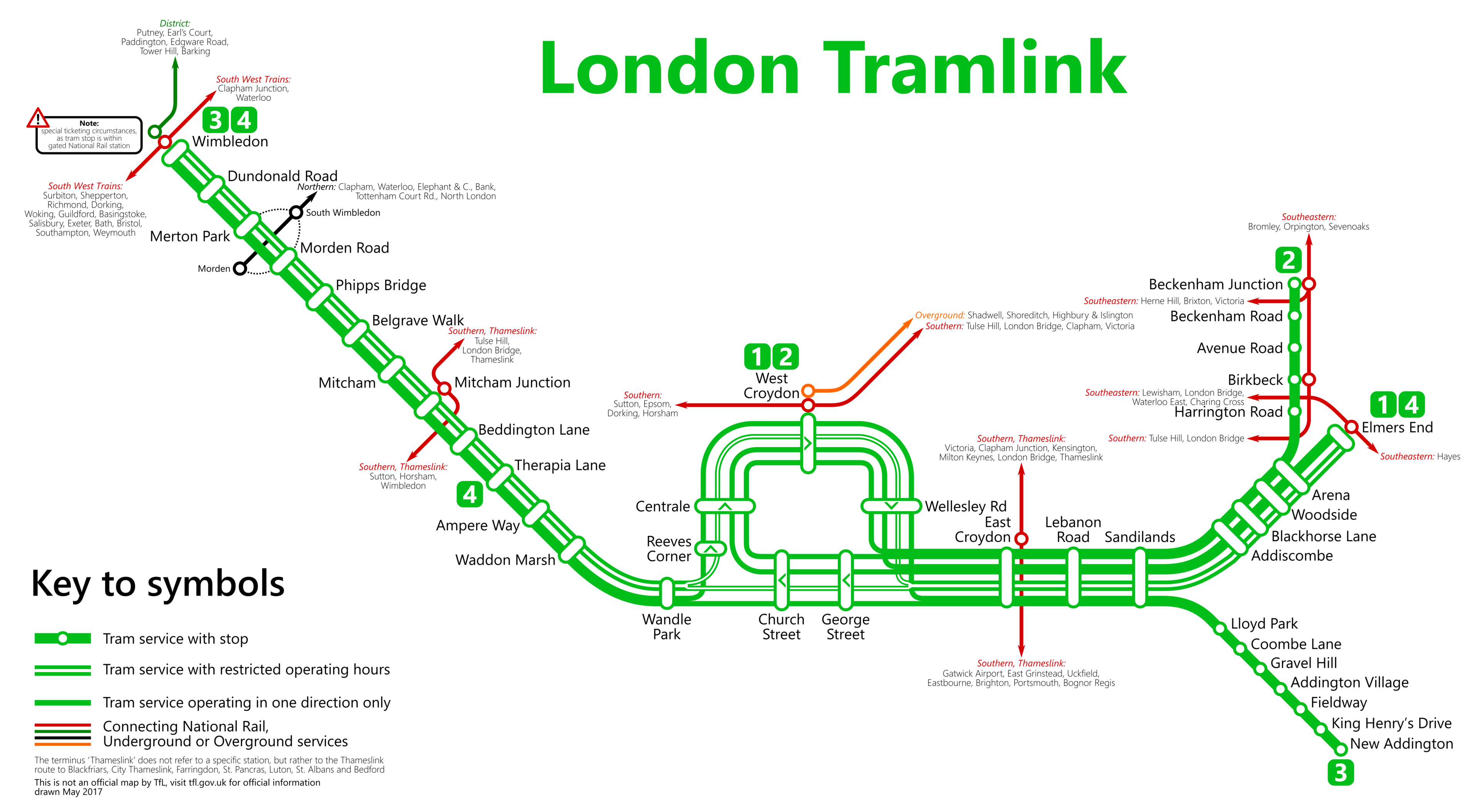
Welcome to the London Trams lines maps online. See the stations on the map below.
 From Metrophil - Autor, CC BY-SA 4.0.
Should you wish to explore the entirety of the London Underground network, you are invited to view the comprehensive London Tube map. This resource includes a page where all lines are neatly presented together (yet distinctly separate), or you may opt to examine individual lines simultaneously.
List of the London Tram stations and routes
Route 1: Beckenham Junction - Wimbledon
| STATIONS | ZONE | INFO |
|---|---|---|
| Beckenham Junction | --- | |
| Beckenham Road | --- | |
| Avenue Road | --- | |
| Birkbeck | --- | |
| Harrington Road | --- | |
| Arena | --- | |
| Woodside | --- | |
| Blackhorse Lane | --- | |
| Addiscombe | --- | |
| Sandilands | --- | |
| Lebanon Road | --- | |
| East Croydon | --- | |
| George Street | --- | |
| Church Street | --- | |
| Wandle Park | --- | |
| Waddon Marsh | --- | |
| Ampere Way | --- | |
| Therapia Lane | --- | |
| Beddington Lane | --- | |
| Mitcham Junction | --- | |
| Mitcham | --- | |
| Belgrave Walk | --- | |
| Phipps Bridge | --- | |
| Morden Road | --- | |
| Merton Park | --- | |
| Dundonald Road | --- | |
| Wimbledon | --- |
Route 2: Elmers End - Wimbledon
| STATIONS | ZONE | INFO |
|---|---|---|
| Elmers End | --- | |
| Arena | --- | |
| Woodside | --- | |
| Blackhorse Lane | --- | |
| Addiscombe | --- | |
| Sandilands | --- | |
| Lebanon Road | --- | |
| East Croydon | --- | |
| George Street | --- | |
| Church Street | --- | |
| Wandle Park | --- | |
| Waddon Marsh | --- | |
| Ampere Way | --- | |
| Therapia Lane | --- | |
| Beddington Lane | --- | |
| Mitcham Junction | --- | |
| Mitcham | --- | |
| Belgrave Walk | --- | |
| Phipps Bridge | --- | |
| Morden Road | --- | |
| Merton Park | --- | |
| Dundonald Road | --- | |
| Wimbledon | --- |
Route 3: New Addington - Church Street
| STATIONS | ZONE | INFO |
|---|---|---|
| New Addington | --- | |
| King Henry's Drive | --- | |
| Fieldway | --- | |
| Addington Village | --- | |
| Gravel Hill | --- | |
| Coombe Lane | --- | |
| Lloyd Park | --- | |
| Sandilands | --- | |
| Lebanon Road | --- | |
| East Croydon | --- | |
| George Street | --- | |
| Church Street | --- |
London tube map | Timetable | Fares | All tube lines