Jubilee Line Map
Updated: January 2025
The Jubilee Line, a symbol of London's rich history and modern development, was initially planned to open in 1977, aligning with Queen Elizabeth II's Silver Jubilee. Despite its name, the line's opening was delayed until 1979, two years after the grand celebration.
The line, known for its distinctive grey colour on the Tube map, was not just a new addition but also a blend of historical routes, taking over sections of the former Metropolitan and Bakerloo lines.
Jubilee Line
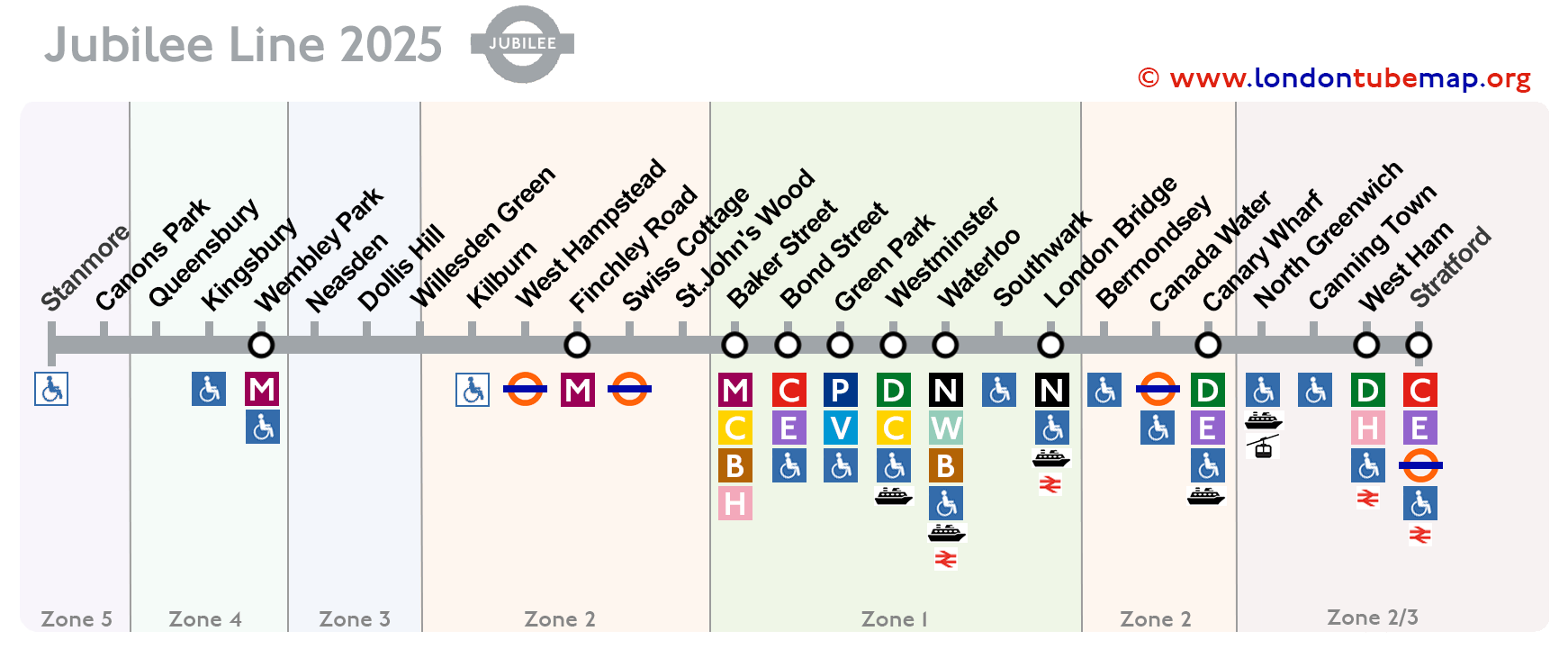
See the stations on the map below (January 2025):
Overview of the Jubilee Line:
- Opened in 1979.
- Colour: grey.
- Underground.
- 27 stations.
- 36 km (28.5 miles) long.
Should you wish to explore the entirety of the London Underground network, you are invited to view the comprehensive London Tube map. This resource includes a page where all lines are neatly presented together (yet distinctly separate), or you may opt to examine individual lines simultaneously.
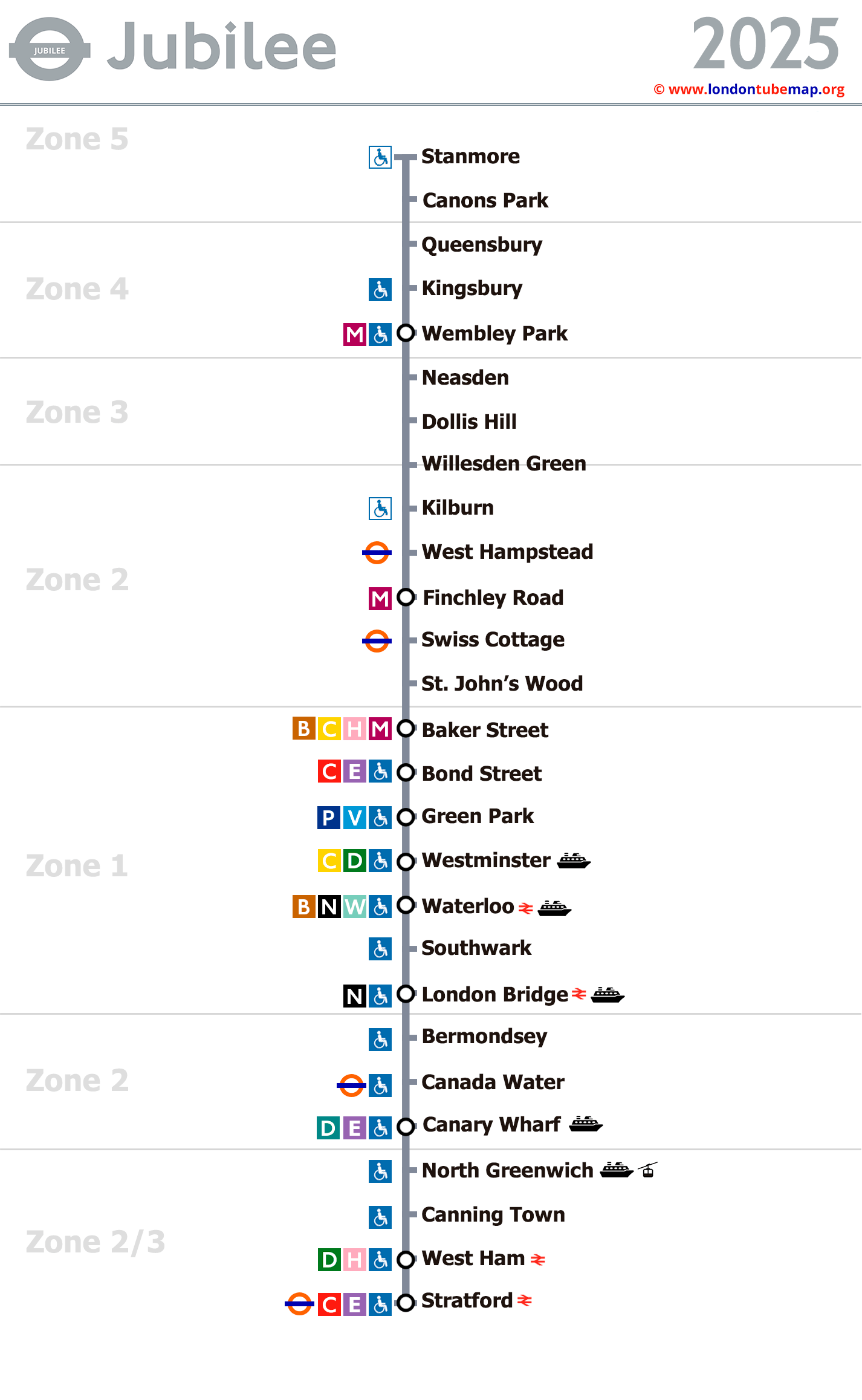
List of Jubilee line stations
Here is the list of all Jubilee line stations, which in total has 27 stops.
If you click on the name of the station, you can see real-time timetable information and more detailed info. If you click on the line icons, you will see information about that line and its transfers.
Route: Stanmore - Stratford
| STATIONS | ZONE | INFO |
|---|---|---|
| Stanmore | 5 | |
| Canons Park | 5 | |
| Queensbury | 4 | |
| Kingsbury | 4 | |
| Wembley Park | 4 | |
| Neasden | 3 | |
| Dollis Hill | 3 | |
| Willesden Green | 3/2 | |
| Kilburn | 2 | |
| West Hampstead | 2 | |
| Finchley Road | 2 | |
| Swiss Cottage | 2 | |
| St. John's Wood | 2 | |
| Baker Street | 1 | |
| Bond Street | 1 | |
| Green Park | 1 | |
| Westminster | 1 | |
| Waterloo | 1 | |
| Southwark | 1 | |
| London Bridge | 1 | |
| Bermondsey | 2 | |
| Canada Water | 2 | |
| Canary Wharf | 2 | |
| North Greenwich | 2/3 | |
| Canning Town | 2/3 | |
| West Ham | 2/3 | |
| Stratford | 2/3 |
London tube map | Timetable | Fares | All tube lines