London Cable Car Line Map – IFS Cloud Cable Car
Updated: January 2025
Welcome to our page featuring maps of the London Cable Car, also known as the Dangleway or LCC. Previously named the Emirates Air Line until June 2022, this iconic aerial transport route has been rebranded as the IFS Cloud Cable Car from October 2022.
The London Cable Car offers a unique way to cross the River Thames, providing spectacular aerial views of the city. More than just a means of transportation, it serves as a popular tourist attraction, allowing visitors and locals alike to experience London from a different perspective.
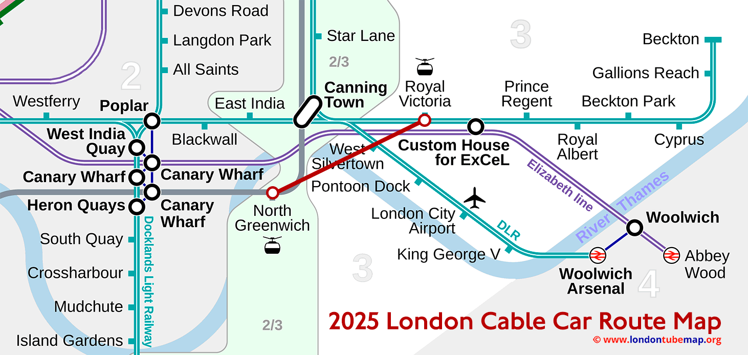
London Cable Car Line map.
Below you can find the LCC line map.
The London Cable Car was inaugurated on 28 June 2012, and was operated by Emirates Air Line for ten years until June 2022, which is why it has been called the Emirates Air Line or Emirates Cable Car.
This project was initially planned in 1990 as an ecological transport alternative to polluting wheeled vehicles, and its route was originally much longer than it is now, but due to various problems, the project was halted in 1998 and did not resume until 2010, although this time the project continued with a significantly shorter route than originally planned and so it was finally launched two years later, in 2012.
You can also view the entire London tube map if you wish, a single page featuring all the lines grouped together (but separate, one by one), or view other lines simultaneously.
List of stations
This is the list of all stations of London Cable Car, which has only two stops.
| STATIONS | ZONE | INFO |
|---|---|---|
| Greenwich Peninsula | --- | |
| Royal Docks | --- |
London tube map | Timetable | Fares | All tube lines