Hammersmith & City Line Map – Pink Line
Updated: January 2025
The Hammersmith & City Line, known for its distinctive pink colour, shares several stations with the Circle and District Lines. This line is a key transport link for residents in West London, providing convenient access to the heart of the city.
Originally a part of the Metropolitan Line, the Hammersmith & City Line was established in its current form in 1988. Its stations are steeped in history, forming part of the network of the Metropolitan Railway, the world's first underground railway, which commenced operations in 1863.
Hammersmith & City Line
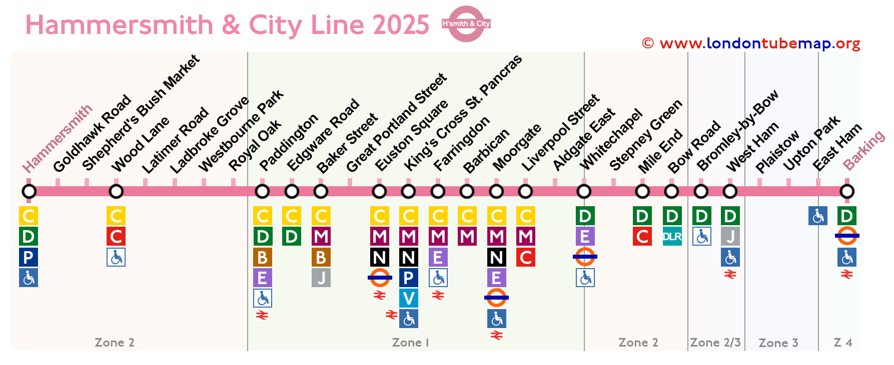
Check out the stations on the map below as of January 2025.
Overview of this tube line:
- Opened in 1988.
- Colour: pink.
- Underground.
- 29 stations.
- 25 km (15.5 miles) of track.
Should you wish to explore the entirety of the London Underground network, you are invited to view the comprehensive London Tube map. This resource includes a page where all lines are neatly presented together (yet distinctly separate), or you may opt to examine individual lines simultaneously.
List of Hammersmith & City line stations
Here is a list of the 29 tube stations on the Hammersmith & City line, if you click on the name of the line you will see more information such as real time timetables.
If you click on the icons in the "Info" column, you can see more details of the line or drawing.
Route Goldhawk Road - Barking
| STATIONS | ZONE | INFO |
|---|---|---|
| Hammersmith & City (H&C line) | 2 | |
| Goldhawk Road | 2 | |
| Shepherd's Bush Market | 2 | |
| Wood Lane | 2 | |
| Latimer Road | 2 | |
| Ladbroke Grove | 2 | |
| Westbourne Park | 2 | |
| Royal Oak | 2 | |
| Paddington | 1 | |
| Edgware Road | 1 | |
| Baker Street | 1 | |
| Great Portland Street | 1 | |
| Euston Square | 1 | |
| King's Cross St. Pancras | 1 | |
| Farringdon | 1 | |
| Barbican | 1 | |
| Moorgate | 1 | |
| Liverpool Street | 1 | |
| Aldgate East | 1 | |
| Whitechapel | 2 | |
| Stepney Green | 2 | |
| Mile End | 2 | |
| Bow Road | 2 | |
| Bromley-by-Bow | 2/3 | |
| West Ham | 3 | |
| Plaistow | 3 | |
| Upton Park | 3 | |
| East Ham | 3/4 | |
| Barking | 4 |
London tube map | Timetable | Fares | All tube lines